Project Lead: Siddhartho (Sidd) Paul
Other Team Member: Lyndsey Dowell, MSc student
Project Type: Graduate thesis
Supervisor: Dr. Sean Smukler
Funders: British Columbia Ministry of Agriculture, Natural Sciences and Engineering Research Council of Canada (NSERC), Mitacs Accelerate
Research Overview
Soil organic carbon (SOC), the largest terrestrial pool of organic carbon is critical for climate change mitigation and adaptation as well as for ensuring the sustainability of agricultural production. Intensive agricultural land use practices often result in a severe decline in SOC. Lower Fraser Valley (LFV), one of the most productive agricultural regions of British Columbia has been predicted with the risk of degradation of SOC. Although intensive agricultural production and land use land cover (LULC) changes are the major drivers of SOC loss, incorporating sustainable LULC practices, like grassland rotations, cover cropping, hedgerows, riparian buffers and other beneficial management practices (BMPs) can reduce or even reverse these trends. Therefore, the objective of this project is to understand the spatiotemporal changes in SOC under various LULC practices in the agricultural landscape of LFV. This project will build off of the approach used to map SOC and workability in Delta BC completed in 2017. Generally, our approach will utilize time series satellite data to map LULC and SOC at various time steps.
Research Objectives
The specific objectives of this research are to:
(1) identify the trajectories of LULC change from 1978 to 2018 at 30 m spatial resolution;
(2) detect the changes in SOC from 1978 to 2018 by generating digital maps of SOC at 5 years intervals;
(3) evaluate the relationship between the landscape scale changes in SOC and LULC; and
(4) produce digital maps of SOC for the year 2050 under several projected LULC and climate change scenarios.
Approach
Satellite imagery-based RS analysis of agricultural landscapes is challenging due to the heterogeneity and seasonal and inter-annual variation in land use. We will overcome this challenge by using multiple images captured during the period from April to September to represent the whole crop calendar of the 1,280 km2 of the ALR in the LFV. We will use an object-based image classification for LULC change mapping while SOC mapping will be conducted using point soil data.
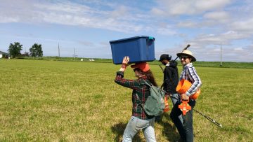
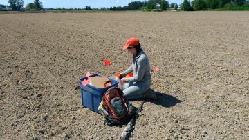
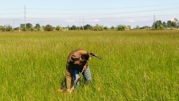
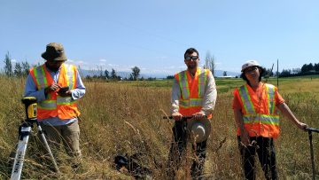
We are targeting 300 sample locations across LFV using the Conditioned Latin Hypercube spatial sampling technique. These sample locations will represent various LULC types, including annual and perennial croplands, grassland set-aside rotations, hedgerows, riparian buffers, and un-vegetated farm edges. At each of these locations, 4 soil samples will be collected and composited to represent an area of 1000 m2 while LULC information will be collected for an area representing a single land use unit. We will sample at 4 depth intervals 0-15, 15-30, 30-60, and 60-100 cm to quantify SOC and cumulative mass while bulk density will be measured at 7.5 and 22 cm depths. Soil will be analyzed using both standard laboratory analysis and Fourier-transform infrared spectroscopy (FTIRS) to develop spectral libraries of the soil to reduce future analysis costs. We will combine these field data with various spectral and topographic indices derived from the satellite and digital elevation data using a random forest machine learning model for producing the LULC and SOC maps. We will incorporate the changes in LULC and climatic patterns (e.g. precipitation and temperature) into the models to understand their relationships with the dynamics of SOC. Both the LULC and SOC map of 2018 will be calibrated and validated using our field data. We will then use these models to produce maps of the past years in 5-year time steps by changing the spectral covariates and climate data. Past LULC and SOC data from the archived land use inventory and soil survey will be used to validate modeled maps for 1-time step. The performance of maps will be assessed based on a suite of accuracy metrics. The validated model will then be used to predict the SOC maps of 2050 under several LULC and climate changes scenarios.
Expected outcomes of the project
Digital soil maps produced from this project will be made available online for download to provide a valuable resource to:
- Farmers in the region with a better understanding of the dynamics of soil organic carbon, a key soil quality parameter to help them adapt to and mitigate climatic change.
- Improve regional planning for climate change adaptation and mitigation as well as the development of BMPs and associated incentive programs designed to improve agricultural sustainability.
Preliminary results
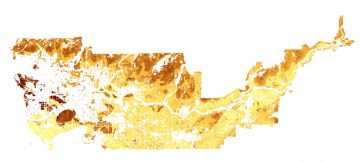
1. Soil organic carbon map – Lower Fraser Valley:
We generated soil organic carbon (SOC) maps for the Lower Fraser Valley for the years 1984, 1990, 1999, 2009, and 2018. Our maps focus on the 0-15 cm depth.
- To view the digital web maps for all years – CLICK
Year Soil organic carbon range (%)
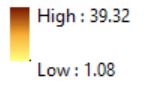
- 2018 1.08 – 39.32
- 2009 1.73 – 32.65
- 1999 3.10 – 33.50
- 1990 3.86 – 33.09
- 1984 2.02 – 33.30
- 2018 SOC map (SOC was not predicted for the built-up/bare land and water areas)
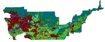
2. Land use-land cover map – Lower Fraser Valley:
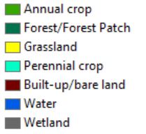
We generated land use land cover (LULC) maps for the Lower Fraser Valley for the years 1984, 1990, 1999, 2009, and 2018. We identified 7 LULC classes, namely annual crop, perennial crop, grassland, forest/forest patch, built-up/bare land, water, and wetland.
- To view the digital web maps for all years – CLICK
- 2018 LULC map
3. Cost-benefit analysis: CLICK
Land use – land cover changes in Delta, BC as shown with Landsat timelapse (1985-2012)
Research Assistants
The following undergraduate students have been assisting with this project: